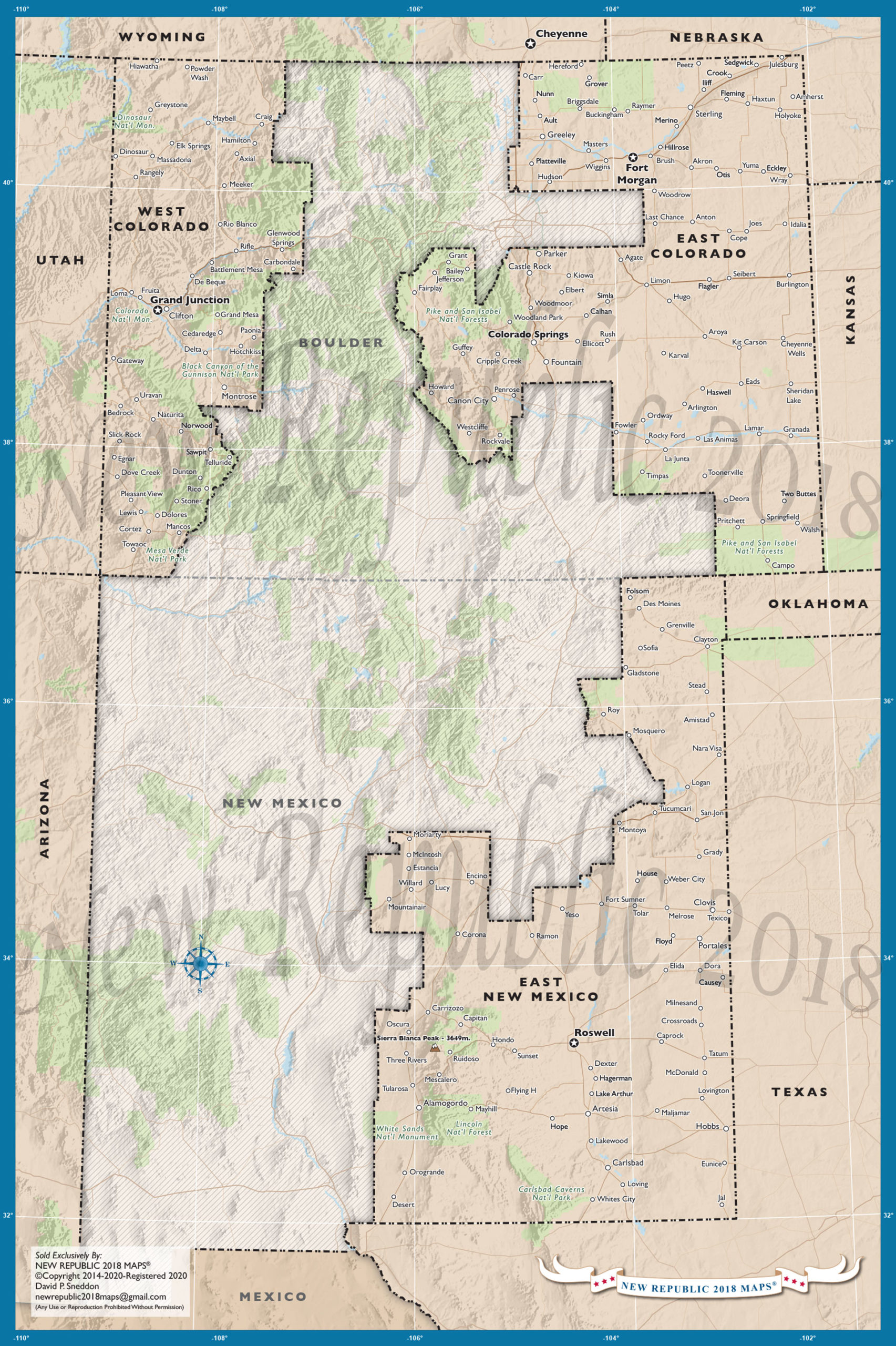
Colorado/New Mexico Map
The Colorado-New Mexico map is one of (NR’s) earlier maps. It has remained on the website because it gives a glimpse of 2012 Presidential voting patterns. A year after the 2012 election, the Denver Post wrote, “A plan to carve off the northeastern corner of the state, and form (North Colorado) was hatched at a Colorado Counties conference in 2013.” The North Colorado movement had legs for a few years but ended in defeat. Prior to the 2016 election, Colorado could have realistically separated into three states (2 RED, 1 BLUE). After the 2016 election though, only an eastern region split remained viable….(See Colorado – New State – section, represents an accurate 2016 two state split)
New Mexico on the other hand, had a different set of map issues. New Mexico is a mixture of tribal lands, deep BLUE cities like Albuquerque and Santa Fe, plus a large cluster of RED counties in the east. Through the years, the eastern counties have remained steadfastly RED, but low population numbers remained troublesome. Skeptics of a state split would also tout a marginal economic base for eastern counties. But, those who live in the east region of New Mexico will say…. “we are fine, so damn well leave us and the space ALIENS alone”. Yep, Roswell is located in the RED county of Chaves!